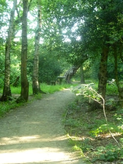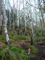
Buck Wood lies to the north of the urban village of Thackley, which is on the northern edge of the city of Bradford, West Yorkshire.
Along the north-western edge of Buck Wood the canal runs parallel to the River Aire, and follows the river round a noticeable eastward bend in its course. Above the river valley Buck Wood forms a broad semi-circular zone of woodland, interspersed with small long-established fields. It is part of a string of other similar woods which together form a woodland corridor along this part of the Aire Valley.
Buck Wood covers about 42 hectares of land. The lowest part of the Wood adjoins the canal and river valley, and is around 60m above sea-level. This valley forms the north-western boundary of the Wood, whilst the highest area is alongside Ainsbury Avenue which forms the eastern boundary. The height of this wide and fairly level section is approximately 135m above sea level. At the northern edge Buck Wood is bordered by Field Wood,which now belongs to Yorkshire Water. Farmland and Thackley’s streets and houses create the southern boundary of the Wood.
Between the canal and the river, just attached to the south-eastern corner of Buck Wood, is the barely-visible site of Buck Mill. The Friends of Buck Wood include this extra piece of land as part of Buck Wood, because the Mill has had a major role in the history of the Wood and of Thackley itself.
The Stones of Buck Wood
If you want a quick guide to some old and new aspects of Buck Wood, you can find one by clicking this link. It describes some of the fossils and other historic stones in the Wood.
Or you can download a different leaflet with a map, which tells all about the modern carved rocks which were created by sculptor Ian Taylor in 2011 as a community project for Thackley and Buck Wood. Click on this link: stones_walk___map.pdf. Print or download the leaflet and use it as the basis of a walk, and try to spot all ten of our unique modern stone carvings – and enjoy Thackley’s lovely woodland at the same time.


